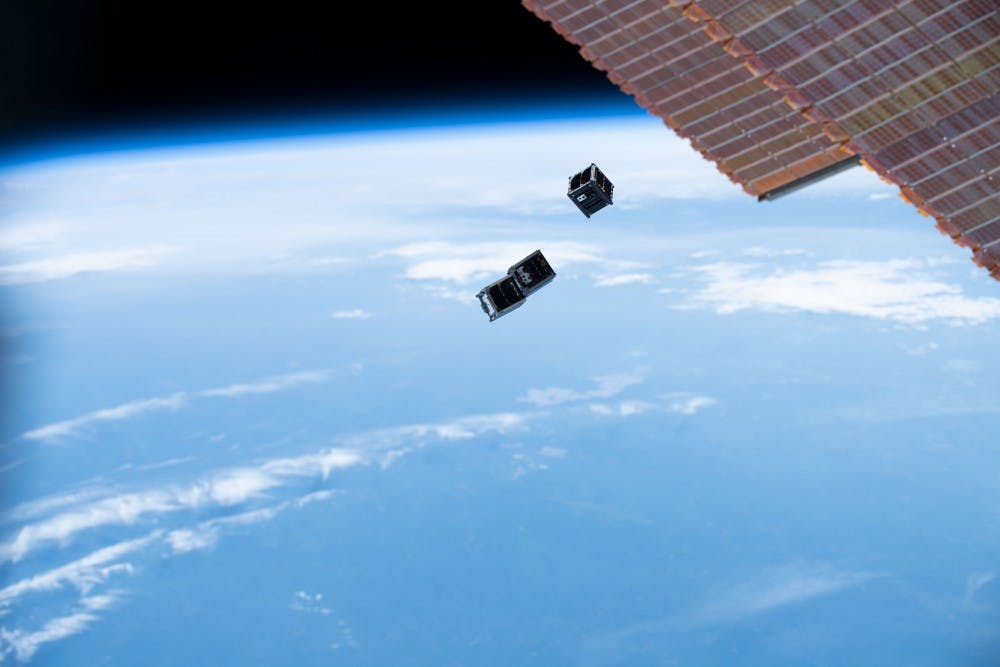
It’s been four months since the 10-centimeter cubed satellite known as Libertas, designed by a team of U.Va. undergraduate aerospace engineering students, was rocketed to the International Space Station. After a few months in storage, the CubeSat was deployed into orbit July 3 to measure atmospheric drag for future space exploration missions.
Now that Libertas is in space alongside similar 1U CubeSats — 1U meaning they are of standard 10-centimeter cubed size — designed by Virginia Tech and Old Dominion University, the next step is establishing communication. In order to do this, each team must point an antenna towards the direction of their CubeSat each time it flies over their respective universities’ ground station. Over the next year, the CubeSats are expected to orbit Earth every 90 minutes, passing over each location 2-3 times a day.
Since the CubeSats’ deployment, the U.S. Air Force has tracked and published information on the satellites’ locations, allowing the teams to predict each flyover. This is where Connor Segal, a rising fourth-year aerospace engineering student and student consultation lead for the project, says the preliminary task begins.
“The Air Force can tell you there is something up there, but they can’t tell what it is, so now we have the three tracking informations for each university, but we don't know whose is whose,” Segal said. “Our preliminary task right now is differentiating between [each satellite] based on the orbital tracking information.”
Though the three CubeSats are the same standard size, there are slight differences amongst them which will help with identification. For example, one CubeSat has a drag brake, causing it to slow down and deorbit faster.
“Once we’ll be able to tell the relative separation between them, we’ll be able to compare what we know about the satellites and their physical shape,” said Hannah Umansky, a rising fourth-year aerospace engineering student and team member of the mission. “Using our ground stations, we’ll be able to tell which satellite picks up on which signal better.”
In order to contact Libertas, a “wake-up command” was sent up by U.Va. An acknowledgement packet — a unit of data that must be decoded — was sent back, responding to the ground station signal. Due to technical difficulties with the University’s ground station caused by a series of lightning storms, the Virginia Tech ground station was able to listen in and receive the response signal. By achieving this one-way communication, Libertas is currently the only CubeSat which has responded to a signal, showing that it is alive and working.
“Initially from deployment, we don't know if the satellite is on, or whether something broke,” Segal said. “You don't know if maybe the antenna didn't deploy or the board was hit with a cosmic ray, so the initial step is establishing contact and seeing whether the satellite is alive or not.”
Though the team has not made two-way communication with the satellite, meaning they have not received data, Segal is happy with where the team is at.
“It's not unlikely for CubeSats to take a few weeks or a month, maybe even two months to establish contact,” Segal said. “So far all of our expectations are met, it's still a big accomplishment to have gotten everything finished and gone up to space.”
In order to receive science data, an onboard GPS is used to record the location, altitude and velocity of the CubeSat during each flyover. From there, the team can identify how much the spacecraft has slowed down, therefore allowing them to determine the density of the atmosphere which the CubeSat is flying through. This is the main science goal that Chris Goyne, associate professor of mechanical and aerospace engineering, has been working on with the students.
“If we have data information about the atmosphere … we'll know how much fuel, for example, is required to keep a spacecraft in orbit,” Goyne said. “And, if the spacecraft is very large, some of the parts will land on the ground, so being able to predict how the spacecraft will reenter the atmosphere and where those parts will land are helpful to keep people safe on the ground.”
With the 1U mission off to a successful start, Umansky is leading a second CubeSat project, currently in the conceptual stage. Rather than collaborating with other universities, Umansky and the team will collaborate with the U.Va. environmental science and astronomy departments to create a CubeSat three times the standard size. Known as a 3U CubeSat, the satellite will measure nitrogen dioxide levels — an indicator of pollution caused by humans — above cities.
“We are working together to create a CubeSat that has half the space allotted to the functions of the satellite, so things like its positioning and antennas, power and onboard computers, and the other half of the volume is dedicated to a scientific instrument called a spectrograph,” Umansky said. “The satellite will image the earth and spread light through the spectrograph to determine the presence of nitrogen dioxide.”
According to their current timeline, the building stage should be underway next summer or fall, and the 3U CubeSat should be launched in late 2021.


