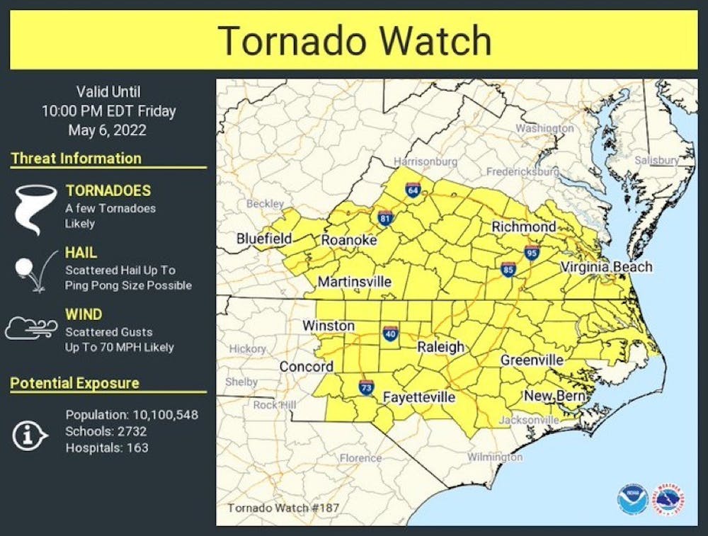
A tornado watch has been issued for a vast swath of the southern Mid-Atlantic, including the City of Charlottesville and the University of Virginia, until 10:00 p.m. Friday.
A tornado watch does not mean a tornado is imminent. Rather, a watch means that those within the alerted area should pay close attention to the weather forecast and be prepared to take shelter in the event a tornado warning is issued.
A few tornadoes are likely to touch down within the watch zone — the National Weather Service says that there is a 60 percent chance of two or more tornadoes touching down, with a 20 percent of a strong tornado within the watch area.
Tornadoes are not the only threat that today’s potential severe storms will pose, though. Scattered damaging wind gusts of up to 70 miles per hour are likely within the watch area, as well as hailstones that could be as large as ping pong balls.
Charlottesville is on the northern end of the tornado watch area, which also encompasses cities like Richmond, Virginia, Virginia Beach, Virginia and Raleigh, North Carolina.
In the event of a tornado warning on-Grounds, the University will warn students in a number of ways, including from email and text alerts for those who have registered, the use of a siren on-Grounds and emergency displays on on-Grounds LED clocks and LCD scenes. Alerts will also be posted on the @UVA_EM Twitter page.
When a tornado warning is issued, the National Weather Service urges those in the warning to shelter immediately in the lowest level of your home or apartment building, away from windows. Tornadoes can be difficult to see, especially late at night and when obscured by rain.
Any changes to the University’s operational status will be posted on the Operations Status Board, which is run by University Emergency Management.


